Have you ever wondered how sailors in ancient times were able to navigate vast oceans without the use of modern technology? The answer lies in the fascinating field of astronomy and its vital role in navigation and timekeeping. Through the observation of celestial bodies and the development of sophisticated instruments, early mariners were able to determine their position and accurately keep track of time. In this article, we will explore the ancient navigation techniques, the development of astronomical instruments, the role of astronomy in solving the longitude problem, and the modern applications of astronomy in navigation and timekeeping. So, let’s embark on a journey through history and discover the significance of astronomy in guiding sailors across the seas.
Contents
- Ancient Navigation Techniques
- Development of Astronomical Instruments
- Astronomy and the Longitude Problem
- Modern Applications
- Conclusion
-
Frequently Asked Questions
- How did ancient mariners navigate without modern instruments?
- What is astrometry?
- How did sailors use celestial navigation?
- What is an astrolabe?
- What is a sextant?
- Who was John Harrison?
- What was the role of the marine chronometer in navigation?
- What is the Nautical Almanac?
- How does GPS use astronomy?
- What is the role of atomic clocks in modern navigation?
- References
-
Frequently Asked Questions
- How did ancient civilizations navigate using astronomy?
- What is astrometry and how is it used in navigation?
- How did ancient navigators use celestial navigation?
- What is an astrolabe and how was it used in navigation?
- What is a cross-staff and how was it used in navigation?
- What is a sextant and how does it improve celestial navigation?
- How did John Harrison solve the longitude problem with a marine chronometer?
- What is the significance of the Nautical Almanac in navigation?
- How does the Global Positioning System (GPS) use astronomy?
- What role do atomic clocks play in modern navigation?
- References
- Read More
Ancient mariners relied on two main navigation techniques: astrometry and celestial navigation. Astrometry involves the precise measurement of the positions and movements of celestial bodies, such as stars and planets. By observing the positions of these celestial objects and comparing them to known reference points, sailors could determine their latitude and approximate longitude. Celestial navigation, on the other hand, involved using the positions of celestial bodies to determine direction and navigate to a desired destination. Sailors would use landmarks in the night sky, such as the North Star or the constellations, to determine their heading. By combining these techniques, ancient mariners were able to navigate across vast expanses of the open seas with remarkable accuracy. It’s truly fascinating how our ancestors were able to master the night sky to traverse the world’s oceans centuries ago.
Astrometry
Astrometry, a fundamental technique in navigation and timekeeping, involves the precise measurement of the positions and movements of celestial bodies. This ancient practice allowed sailors to determine their latitude and approximate longitude. Using astrometry, mariners observed the positions of stars, planets, and other celestial objects. They compared these observations to known reference points, such as the celestial equator or specific stars, to calculate their position on Earth. Sailors would typically use an instrument called an astrolabe, which measured the angle between the horizon and a celestial body. The astrolabe provided crucial information about the ship’s location and enabled sailors to plot their course accordingly. This accurate measurement of celestial objects paved the way for successful long-distance voyages, as it allowed sailors to navigate across vast oceans with a considerable degree of precision.
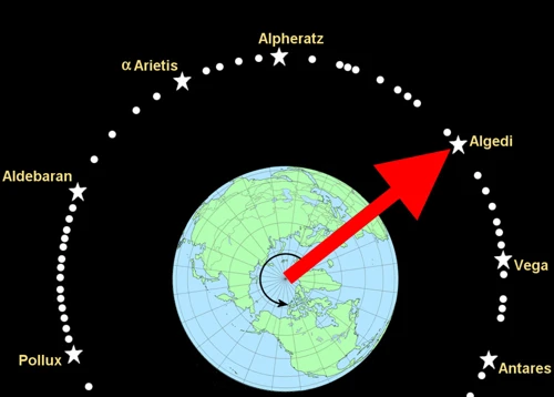
was a vital technique used by ancient mariners to determine their direction and navigate accurately across the seas. It relied on the observation of celestial bodies such as the sun, moon, stars, and planets. Sailors would use these celestial objects as fixed reference points to establish their position relative to them. One of the key stars used for navigation was Polaris, also known as the North Star. Due to its close alignment with the Earth’s north rotational axis, Polaris appeared fixed in the northern sky, making it an excellent navigational guide. Sailors in the Northern Hemisphere could determine their latitude by measuring the angle between the horizon and Polaris using instruments like the quadrant or astrolabe. Additionally, the movement of the sun and stars throughout the day and night provided sailors with information on their heading and time. By tracking the sun’s position relative to the horizon, sailors could determine east-west direction, while observations of star constellations indicated their north-south position. Celestial navigation required a deep understanding of the night sky and the ability to interpret various celestial phenomena. It was a skill passed down through generations, enabling sailors to embark on long voyages and explore distant lands. Even today, celestial navigation remains valuable knowledge, providing a backup method of navigation when modern technology fails.
Development of Astronomical Instruments
The development of astronomical instruments played a crucial role in advancing navigational techniques. One such instrument was the astrolabe. This device, invented by the ancient Greeks and further developed by Islamic scholars, allowed sailors to measure the altitude of celestial bodies above the horizon. By knowing the angle of a specific star or the sun, mariners could calculate their position on the globe. Another instrument, known as the cross-staff, was used to measure angles between celestial bodies. This simple yet effective tool provided sailors with a way to determine their latitude. However, it was the invention of the sextant that revolutionized celestial navigation. This instrument, introduced in the 18th century, allowed for even more precise measurements of celestial angles. With these advancements in astronomical instruments, sailors had the means to navigate the seas with greater accuracy and confidence, pushing the boundaries of exploration and trade routes to new horizons.
Astrolabe
The astrolabe was a revolutionary astronomical instrument that played a crucial role in ancient navigation. It was widely used by sailors, astronomers, and explorers during the medieval period. The astrolabe consisted of a circular disk with engraved markings representing the celestial sphere. It allowed mariners to measure the altitude of celestial bodies above the horizon, such as the Sun or stars. By adjusting the astrolabe’s movable parts, sailors could align it with a specific celestial object, enabling them to determine their latitude and the time of day. This instrument was particularly useful for celestial navigation during daytime when the stars were not visible. The astrolabe’s compact and portable design made it an essential tool for sailors, providing them with valuable information that guided their navigation across unknown waters. Although the astrolabe eventually fell out of use with the advent of more advanced instruments, its impact on ancient navigation cannot be overstated.
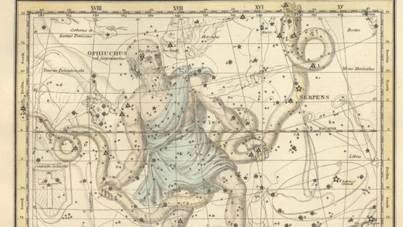
If you’d like to learn more about the fascinating world of astrology, you can explore the concept of nurturing a healthy relationship between Ophiuchus and Cancer.
Cross-staff
The cross-staff was a key astronomical instrument used in navigation during the medieval period. It consists of a long wooden staff with perpendicular crosspieces. One end of the staff was held against the eye of the observer, while the other end was aligned with a celestial body, such as the Sun or a star. By adjusting the crosspiece along the staff, the observer could measure the angle between the celestial body and the horizon. This angle, known as the altitude, was crucial in calculating the observer’s latitude. The cross-staff provided a simple yet effective method for determining a ship’s position at sea. While it had its limitations, such as being less precise than other instruments like the astrolabe, the cross-staff was widely used by sailors and navigators for centuries. Its invention revolutionized celestial navigation and played a significant role in the exploration and discovery of new lands. To learn more about the fascinating stories related to ancient Greek mythology, check out our article on the myth of Persephone.
Sextant
The sextant is a remarkable astronomical instrument that revolutionized navigation during the 18th century. By measuring the angles between celestial bodies, such as the sun and the horizon, the sextant allowed sailors to determine their latitude with high accuracy. The instrument consists of a graduated arc, typically measuring 60 degrees, and a movable index arm with a small telescope mounted on it. To use the sextant, sailors would align the index arm with the celestial body they were observing and adjust the angle until it coincided with the horizon. Through this alignment, they could then read the angle directly from the graduated arc, providing them with their latitude. The sextant’s precision and ease of use made it an essential tool for maritime navigation, greatly improving the accuracy of ship navigation. While modern technology has replaced the sextant in practical navigation, it still holds value as a historical instrument and remains an important symbol of the role astronomy played in advancing navigation techniques.
Astronomy and the Longitude Problem
The longitude problem was one of the most significant challenges faced by navigators in the past. Determining a ship’s longitude while at sea was particularly difficult, as it required an accurate method of keeping time. Without accurate timekeeping, sailors would often find themselves lost and at risk of shipwreck. The breakthrough in solving this problem came with the invention of the marine chronometer by John Harrison. This remarkable timepiece was designed to function accurately even in the harsh conditions of the open sea, allowing sailors to accurately measure the time difference between their current location and a reference point. With the marine chronometer, sailors could then determine their longitude with much greater precision. Another valuable tool introduced during this time was the Nautical Almanac. This publication provided navigators with detailed astronomical data, including the positions of celestial bodies at different times, aiding them in celestial navigation. These advancements in both timekeeping and astronomical knowledge revolutionized navigation, making long-distance sea voyages more reliable and safer than ever before. It’s incredible to think how these innovations contributed to shaping our understanding of the world and expanding global exploration.
John Harrison and Marine Chronometer
John Harrison, an English clockmaker, played a pivotal role in solving the longitude problem with the invention of the marine chronometer. In the 18th century, accurately determining longitude at sea was a significant challenge for navigators, as it required precise timekeeping. Harrison’s marine chronometer was designed to provide highly accurate time measurements, even in the harsh conditions of a ship at sea. The chronometer used a combination of springs, balance wheels, and highly precise gears to maintain a steady rate of timekeeping. Harrison’s first prototype, known as H1, was a large and cumbersome instrument, but it proved the concept’s viability. Over time, Harrison improved his designs, and his final chronometer, H4, was a breakthrough in terms of accuracy and portability. It successfully passed a series of sea trials, and in recognition of his contributions, Harrison was awarded a substantial monetary prize by the British government. The marine chronometer revolutionized navigation, enabling sailors to accurately determine their longitude and greatly improving safety at sea. It laid the foundation for modern maritime exploration and paved the way for advancements in timekeeping technology. To this day, the marine chronometer remains an important part of navigation on ships and boats, maintaining a rich legacy thanks to John Harrison’s ingenuity and perseverance.
The Nautical Almanac
The Nautical Almanac is a crucial tool that revolutionized navigation by providing sailors with valuable astronomical data. Published annually, the Nautical Almanac contains detailed information about the positions and movements of celestial bodies. It includes data such as the rising and setting times of the sun and moon, the positions of stars, and the distances between celestial bodies. This information is essential for calculating a ship’s position at a given time, especially when combined with observations made using instruments like the sextant. Sailors would consult the Nautical Almanac to determine their latitude and longitude based on the celestial observations they made at sea. By knowing the exact positions of celestial bodies at specific times, mariners could accurately plot their course and navigate through vast oceans. The Nautical Almanac continues to be an indispensable resource for navigators to this day, providing them with the celestial data needed to navigate the open seas.
Modern Applications
In the modern era, astronomy continues to play a crucial role in navigation and timekeeping, albeit with more advanced technologies. One of the most significant advancements is the Global Positioning System (GPS). By utilizing a network of satellites orbiting the Earth, GPS allows for precise positioning anywhere on the planet. It has revolutionized how we navigate, from personal devices to aviation and maritime operations. Another modern application is the use of atomic clocks. These highly accurate timekeeping devices, which utilize the vibrations of atoms to measure time, have become essential in various fields, including telecommunications, satellite navigation, and scientific research. They ensure synchronicity and precision in modern timekeeping systems. The combination of astronomy with advanced technologies has greatly enhanced our ability to navigate the world and keep accurate time, making astronomy indispensable in the modern age.
Global Positioning System (GPS)
The Global Positioning System (GPS) is a modern application of astronomy that has revolutionized navigation and timekeeping. GPS is a satellite-based navigation system that provides precise location and time information anywhere on Earth. It consists of a network of satellites orbiting the planet and a receiver that can pick up signals from these satellites. The GPS receiver calculates its position by measuring the distance from multiple satellites and using trilateration. This technology relies heavily on precise timing, which is where astronomy comes into play. The satellites in the GPS system have atomic clocks onboard, which are extremely accurate timekeeping devices. These atomic clocks synchronize with ground-based atomic clocks, which are calibrated using astronomical observations. By precisely measuring the time it takes for signals to travel from the satellites to the receiver, the GPS system can calculate the user’s position with high accuracy. Whether it’s for navigating a vehicle, hiking in the wilderness, or even finding your way in a new city, GPS has become an essential tool for modern navigation. Without astronomy’s contribution to timekeeping, the GPS system wouldn’t be as accurate and reliable as it is today.
Atomic Clocks
Atomic clocks are a remarkable technological advancement that plays a crucial role in modern navigation and timekeeping. These highly precise instruments measure time based on the vibrations of atoms. The most commonly used atom for timekeeping is cesium-133, which oscillates at a specific frequency. By counting the oscillations of the cesium atoms, atomic clocks can measure time with incredible accuracy, only deviating by a few nanoseconds over millions of years. This level of precision is essential for various applications, including navigation systems like the Global Positioning System (GPS). Atomic clocks provide the precise timekeeping necessary for GPS satellites to accurately determine the positions of receivers on Earth. This enables us to navigate with pinpoint accuracy, whether on land, sea, or in the air. Atomic clocks also play a vital role in telecommunications, satellite communication, scientific research, and even financial transactions. Their unmatched precision is truly remarkable, revolutionizing the way we navigate, communicate, and keep time in our modern world.
Conclusion

In conclusion, astronomy has played a crucial role in navigation and timekeeping throughout history. Ancient mariners relied on the observation of celestial bodies and the development of astronomical instruments to determine their position and keep track of time. From astrometry to celestial navigation, these techniques allowed sailors to navigate the vast oceans with remarkable accuracy. The advancements in astronomical instruments, such as the astrolabe, cross-staff, and sextant, further enhanced navigation capabilities. The solving of the longitude problem by John Harrison’s marine chronometer revolutionized maritime navigation. Today, modern applications like the Global Positioning System (GPS) rely on astronomical principles to accurately determine position and guide navigation. Moreover, atomic clocks, based on the principles of quantum mechanics and the behavior of atoms, provide incredibly precise timekeeping. The integration of astronomy and technology continues to shape navigation and timekeeping practices, enabling us to explore the world and beyond. As we look back at the history of astronomy’s role in navigation, we gain a deeper appreciation for the ingenious ways our ancestors navigated the seas, and the continuous advancements that have shaped modern navigation and timekeeping systems.
Frequently Asked Questions

Ancient mariners relied on the observation of celestial bodies and the development of sophisticated instruments, such as astrolabes and sextants, to determine their position and navigate the seas.
What is astrometry?
Astrometry is the precise measurement of the positions and movements of celestial bodies, such as stars and planets. Ancient mariners used astrometry to determine their latitude and approximate longitude.
Sailors used celestial navigation by observing the positions of celestial bodies, such as the North Star or specific constellations, to determine their heading and navigate to their desired destination.
What is an astrolabe?
An astrolabe is an ancient instrument used to measure the altitude of celestial bodies. It enabled sailors to determine their latitude and navigate based on the position of the sun, moon, stars, and planets.
What is a sextant?
A sextant is a navigational instrument used to measure the angle between two celestial objects, typically the horizon and a celestial body. It allowed sailors to determine their position at sea with greater accuracy.
Who was John Harrison?
John Harrison was a British clockmaker and inventor. He is known for inventing the marine chronometer, a device that accurately measured longitude at sea, solving the longstanding longitude problem.
The marine chronometer provided sailors with an accurate method of determining their longitude at sea. It revolutionized navigation by allowing sailors to calculate their position with precision, improving the safety and efficiency of long voyages.
What is the Nautical Almanac?
The Nautical Almanac is a publication that provides navigators with essential astronomical information, such as the positions and movements of celestial bodies. It helps sailors in celestial navigation and timekeeping.
How does GPS use astronomy?
While GPS primarily relies on satellites, the system depends on accurate timekeeping, which is achieved through atomic clocks. The precise synchronization of these clocks, which is based on astronomical observations, ensures accurate positioning and navigation.
Atomic clocks play a crucial role in modern navigation by providing highly accurate timekeeping. They use the vibrations of atoms to measure time with incredible precision, which is essential for systems like GPS that require precise timestamping of signals.
References
Frequently Asked Questions
Ancient civilizations used astronomy as a navigational tool by observing the positions of celestial bodies such as the Sun, Moon, stars, and planets. They mapped out the sky and developed methods to measure and interpret these celestial movements, allowing them to determine their direction and location.
Astrometry is the branch of astronomy that involves precise measurements of the positions and movements of celestial objects. In navigation, astrometry is used to calculate the position of a ship or aircraft using the known positions of stars and planets. This technique allows navigators to determine their latitude and sometimes their longitude.
Ancient navigators used celestial navigation by observing the positions of celestial bodies in relation to the horizon. They would measure the angle between a celestial body, such as the Sun or a star, and the horizon using instruments like astrolabes or sextants. By comparing these measurements with reference tables, they could determine their latitude and approximate longitude.
An astrolabe is an ancient astronomical instrument used for solving problems related to time and the position of celestial objects. In navigation, it was used to measure the altitude of the Sun or stars, which allowed navigators to determine their latitude. It was also used for timekeeping and solving other navigational calculations.
A cross-staff is a simple navigational instrument used in the past to measure the angle between a celestial body, usually the Sun, and the horizon. Navigators would hold the cross-staff vertically and align it with the celestial body and the horizon. By measuring the angle between the two points, they could estimate their latitude.
A sextant is a more advanced navigational instrument that replaced the astrolabe and cross-staff. It uses mirrors and a movable arm to measure the angle between two celestial objects, such as two stars or a star and the horizon. By taking accurate measurements, navigators could determine both their latitude and longitude, significantly improving navigation accuracy.
How did John Harrison solve the longitude problem with a marine chronometer?
John Harrison, a clockmaker, solved the longitude problem by inventing the marine chronometer. This mechanical timepiece could keep accurate time at sea, regardless of the ship’s motion or changing temperatures. By comparing the local time with the time at a reference location, such as Greenwich, navigators could determine their longitude.
The Nautical Almanac is an annual publication that provides essential astronomical data, such as the positions of celestial bodies, for the purpose of celestial navigation. By consulting the almanac, navigators can accurately calculate their position using celestial observations. It has been a crucial tool in maritime navigation for centuries.
How does the Global Positioning System (GPS) use astronomy?
The Global Positioning System (GPS) uses a network of satellites in space to determine the precise location of a GPS receiver on Earth. While GPS itself doesn’t rely on astronomy, the satellites in the system use atomic clocks to maintain accurate timing, which is a result of advancements in astronomical timekeeping.
Atomic clocks play a vital role in modern navigation by providing extremely accurate timekeeping. GPS satellites, for example, use atomic clocks to precisely measure the time it takes for signals to reach receivers on Earth. This timing information is crucial for calculating accurate position information and is also used in other navigation systems and technologies.
References
- The astronomical basis of timekeeping
- Astronomy in Timekeeping and Navigation
- THE QUEST FOR PRECISION: ASTRONOMY AND …